'%3E%3Cmask id='b' fill='%23fff'%3E%3Cuse xlink:href='%23a'/%3E%3C/mask%3E%3Cuse fill='%23414141' xlink:href='%23a'/%3E%3Cg mask='url(%23b)' fill='%23414141'%3E%3Cpath d='M-160-170h300v300h-300z'/%3E%3C/g%3E%3C/g%3E%3C/g%3E%3C/svg%3E)

Flows, Drones and Trains
Experts Unite to Help a Rare Flower Thrive on Remote Rivers
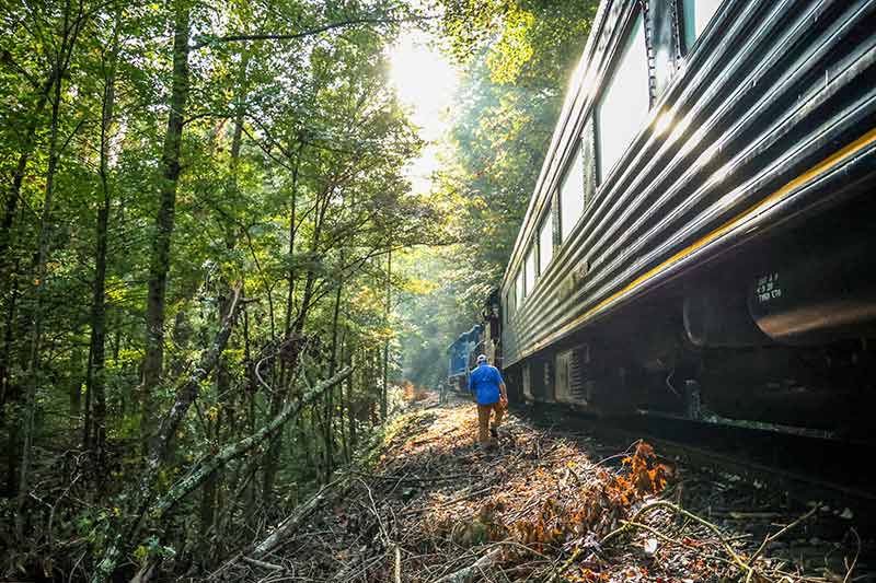
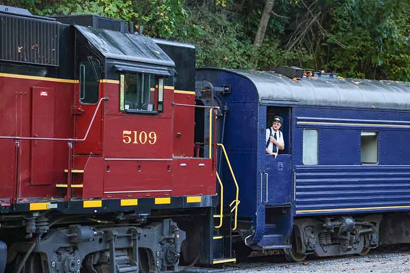
A wailing whistle pierced the fog as a gleaming, three-car classic train sighed to a stop next to the Apalachia Dam powerhouse.
This was no regular ride.
For the next eight hours, a team of scientists, aviators and river managers from Tennessee Valley Authority, the U.S. Forest Service and U.S. Fish and Wildlife Service would ride the rails – the best way to access the remote, rocky reaches of the Hiwassee River.
Along the way, they would take detailed aerial photographs by drone as TVA’s river managers raised the water level.
Their goal? To better understand and conserve habitat for one of the rarest flowers in the world – Ruth’s golden aster.
“You don’t have to look at the Serengeti or the Amazon for rare species,” Adam Dattilo, Tennessee Department of Environment and Conservation vegetation ecologist, said. “You can look here. There are only a handful of other plants capable of growing in that extreme environment.”
As hardy as it is, the flower faces threats. Low river flow and creeping encroachment of trees mean an uncertain number of surviving seedlings each year.
That’s why this team came together today.
“We're on a fact-finding mission,” Geoff Call, U.S. Fish and Wildlife Service conservation delivery coordinator and lead recovery biologist for Ruth's golden aster, said. “(Today will) inform a much bigger discussion about what is possible.”
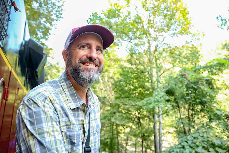
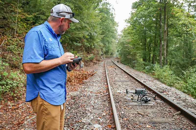
Collin Moyers, TVA program manager for Unmanned Aerial Services, launched a drone and will ride the train to track its path upriver. (Photos by Susan Ehrenclou / TVA)
Scour Powers Flowers
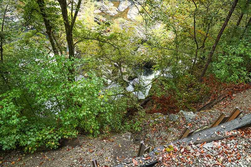
The Ruth’s golden aster flower lives only on phyllite rock on two rivers in the world – the Hiwassee and the Ocoee – flowing through mountains where Tennessee, North Carolina and Georgia meet.
Few records existed about the flower before the Apalachia Dam closed its gates in the 1940s and reduced flow in this 5-mile stretch.
To study the plant, TVA and the U.S. Forest Service conducted in-depth surveys since the 1970s and whole-river census work since 2011.
“We do our best to count every single individual every year,” TVA botanist David Mitchell said. “It's two to three 10-mile days of hard hiking and boulder-hopping.”
"The Hiwassee population of Ruth's golden aster grows on just over 40 rock outcrops,” Dattilo said. “Given that this plant only grows in flood-scoured areas adjacent to a river, we have to get a better understanding of how river flows affect the plant."
This year, with a drone and a train and a multiagency team, they could consider how to help the rare flower like never before.
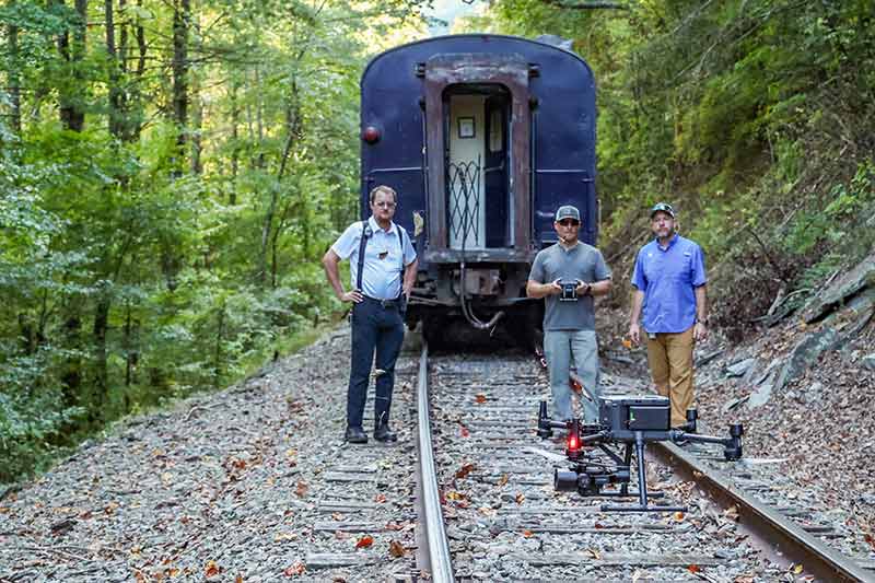
First, TVA’s Aviation Services team offered a drone and pilots to take aerial photos – although at first, the thought of hauling brick-size batteries and a generator through the woods on their backs seemed daunting.
“That's why the railroad helping us here is such a big deal,” Mitchell said.
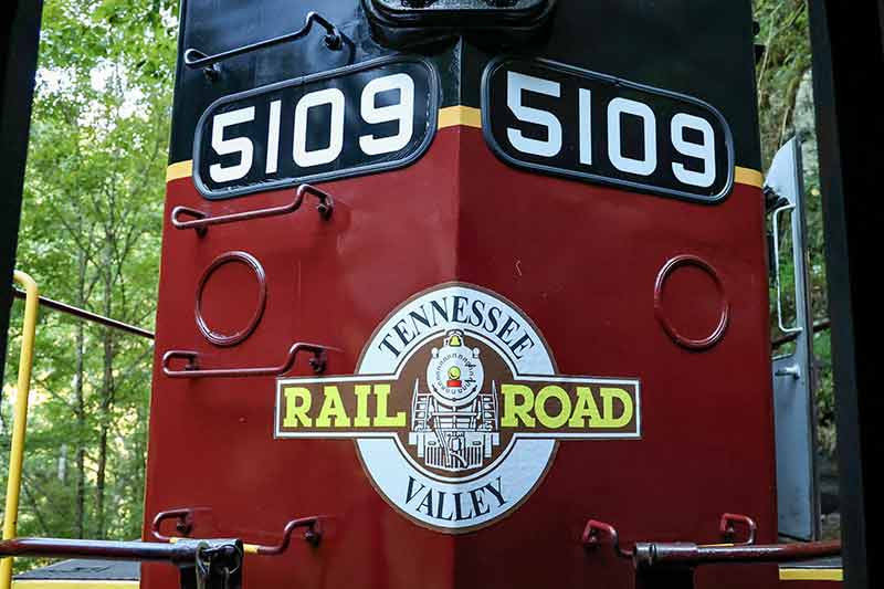
The Tennessee Valley Railroad, whose lines run parallel to the river in this remote reach, proved happy to help transport people and gear.
“This is just awesome,” Jodie Brantley, Tennessee Valley Railroad train engineer and manager of safety and operating practices, said. “TVA’s a great partner. If there’s something we can do to help TVA out, I’m all for it.”
The third key piece fell into place with the help of TVA’s River Forecast Center.
“(The flower lives) in a river scour habitat,” David Mitchell, TVA botanist, explained.
That means occasional fast flows would wash away competing seedlings and bring in fresh soil.
Reintroducing that scour power – in a controlled way – was one proposed recovery plan after the Fish and Wildlife Service listed the Ruth’s golden aster as endangered in 1985.
And controlling water flow is what TVA’s river management system is all about.
“Today, the people in the Forecast Center ... (will) initiate spill just at the right time for us to be in the river,” River Forecast Center engineer Salley Reamer said.
While Tom Zimmerman, lead engineer, coordinated a water release of 1,700 cubic feet per second from Knoxville’s River Forecast Center, Reamer rode the train.
“Without them, we can't do it,” Mitchell said.
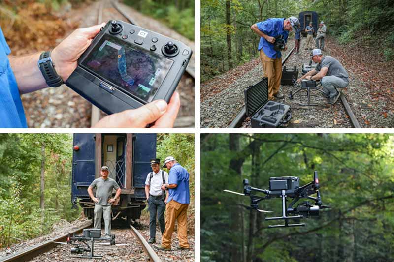
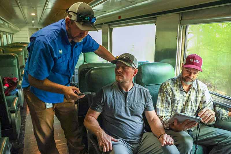
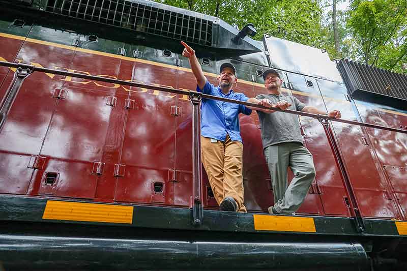
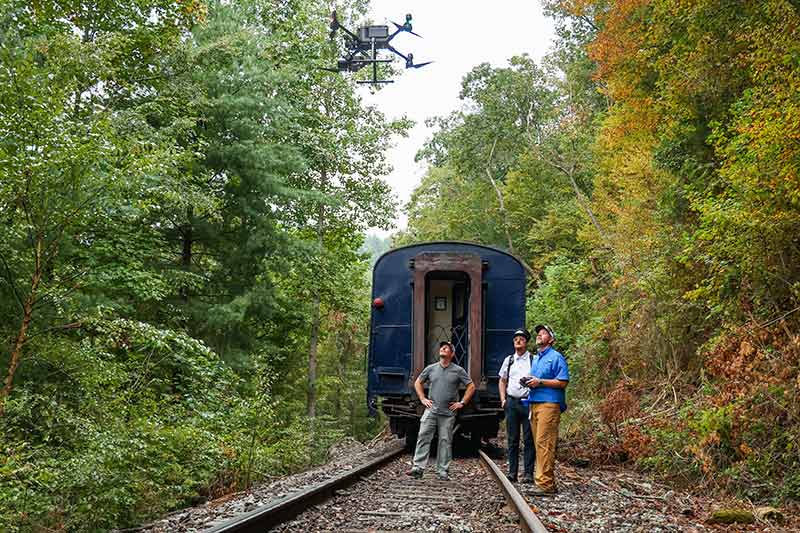
Moyers and Tim Land coordinate train stops with conductor Josh Monroe in a multiagency effort to map endangered Ruth's golden aster by drone.
Send in the drones
From their seats on the train, Collin Moyers and Tim Land, both TVA program managers for Unmanned Aerial Services, looked up from a map and signaled to conductor Josh Monroe.
Monroe nodded.
“Six coach-lengths,” he radioed to engineer Brantley, eyes on the approaching launch point. “Four. One until stop and – stop.”
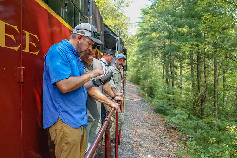
The train whooshed to a halt and the aviators swung out onto the tracks.
They recited their preflight script, confirming fitness for the flight, weather forecast, license information, roles and a step-by-step outline for the flight plan.
And then the drone whirred to life.
Lights flashed and it lifted off, blades buzzing like a swarm of bees.
As it rose, its camera gimble rotated 90 degrees downward to point at the river.
The drone’s precise flight path appeared on the controller Moyers held, the moving line like thread stitching the gap of the river closed.
“We'll film five sections,” Moyers explained. “The entire 3-mile section of the river will be an updated Google Earth image. Very high resolution, where we can zoom in and actually see ... the plant species, the rocks, the vegetation. The total count is going to be over 3,000 images that we’ll stitch together.”
In all, they would do two 400-foot-high drone photography flights.
The first, heading upriver, would take photographs of the river and rocks during regular flow.
The second would repeat the same flight path, taking photos as the train headed downriver alongside a higher, controlled flow of 1,700 cubic feet per second.
“We've defined an area, then the software basically builds a lawn mower pattern,” Land said. “They overlap, and we overlay the (photographs).”
By comparing images, scientists could see for the first time exactly where and how rock habitat changed as the water rose – and plan future efforts to help the flower.
Moyers and Land hopped back on the train, riding in the open air with eyes on the drone.
Monroe pulled out his radio. “Let’s head south, about same speed as last time,” he said.
“We’re going south, about 3.5 mph,” Brantley confirmed.
The stops became a rhythm.
Count the cars. Stop the train. Land the drone. Launch it high. Again. Again. Again.
“Aviation Services has been a great partner in TVA,” Mitchell said. “They're making it happen.”
Monroe, U.S. Forest Service's Allison Williams and TVA's David Mitchell ride the train as a drone photographs Ruth's golden aster habitat.
Riding the Rapids
At 2:30 p.m., the higher flows had hit and the water’s color turned to chocolate milk.
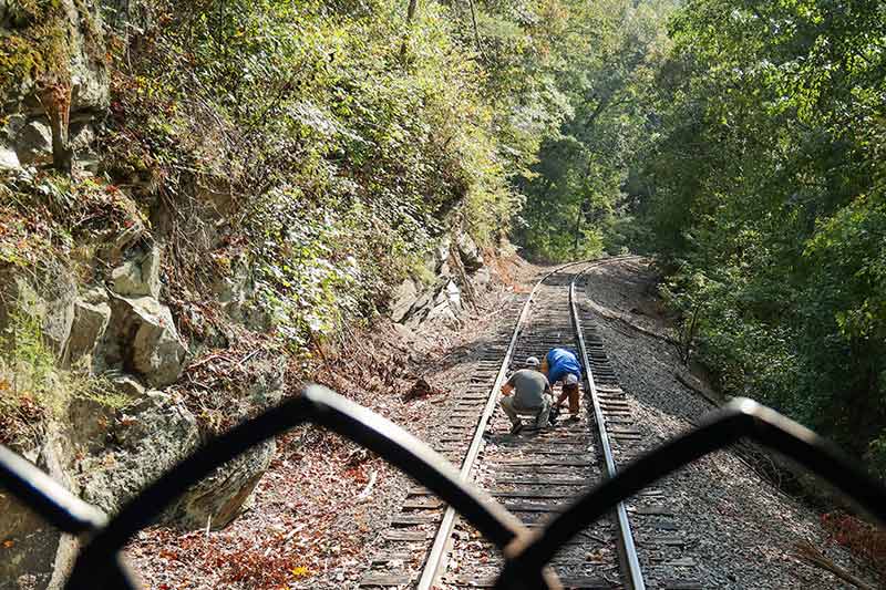
Reamer, Dattilo and Allison Williams, Cherokee National Forest hydrologist, joined a crew of whitewater rafters – stakeholders from the American Whitewater Association, Nantahala Outdoor Center and Southern Environmental Law Center – to inflate boats at the river’s edge.
They would take photos and measurements while navigating downriver on Class III rapids.
The aviation team and botanists would ride back on the train, running the drone’s path in reverse.
On the way down, the river frothed and lapped at its banks. The train rocked on the rails. In the warm afternoon sun, it smelled good, of well-cared-for wood and polished metal.
“That’s where we found 900 plants (yesterday), on that sloped rock,” Mitchell said, pointing to the opposite shore.
Some Ruth’s golden aster flowers shone bright yellow, standing tall. Some waved underwater.
“From here out we can model,” Mitchell said. “The hypothesis is if we put more water in ... it'll move sediment ... (and) hopefully impede woody encroachment.”
Because that’s another question – how to control full-grown trees?
The scientists are still determining what long-term management will look like. In addition to increased river flow, the Ruth’s golden aster may need prescribed fires to clear tall forests shading their habitat and that of river cane and other native plants.
“There's conversation to be had,” Williams said. “What would it all look like? That's part of my curiosity in being here today.”
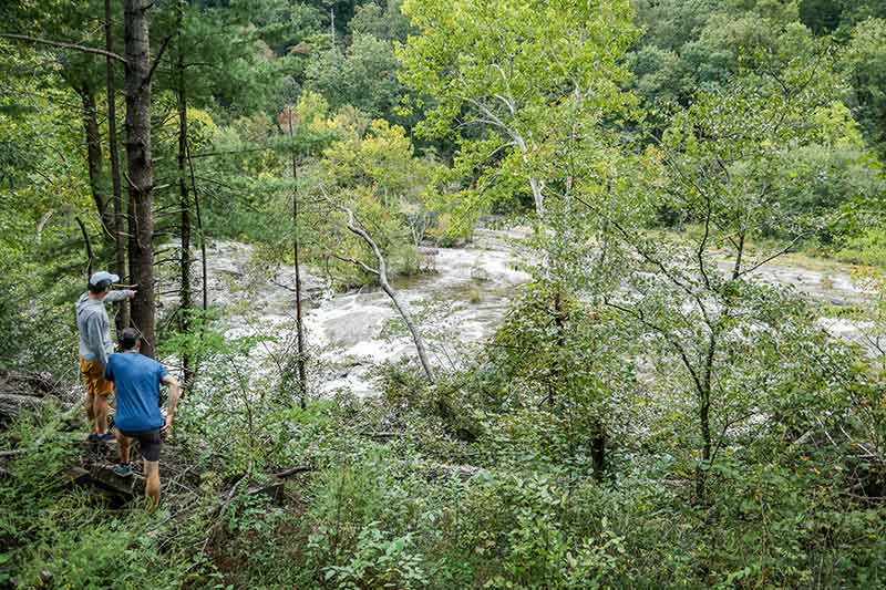
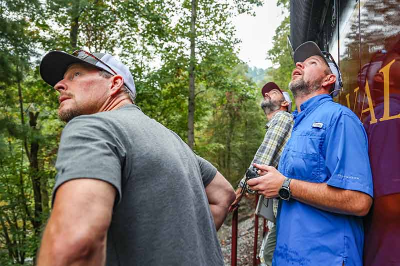
Members of the research team watch as higher river flow reaches Ruth's golden aster habitat on the Hiwassee River.
'It’s Exciting’
As the train neared the powerhouse, the deep valley sank into afternoon shadow.
This wasn’t the last time this team would collaborate and ride these rails – or trek the trails to reach remote rocks.
“Next year we'll do transects and plots,” Mitchell said. “It'll be two years before we (consider) ... experimental flows.”
And Moyers and Land will return to map river contours with lasers.
“This winter season when all the leaves are gone, we’re going to come back and do a LiDAR (Light Detection and Ranging) flight,” Moyers explained.
Putting all these pieces together – photographs, on-the-ground observations and future modeling – to help these rare flowers is an investment in time, people and energy.
But for this team, it’s worth the work.
“It could be a long process to figure it out,” Mitchell said. “This is the first step ... to increase the habitat and potentially (the Ruth’s golden aster) population. It's exciting.”
Photo Gallery
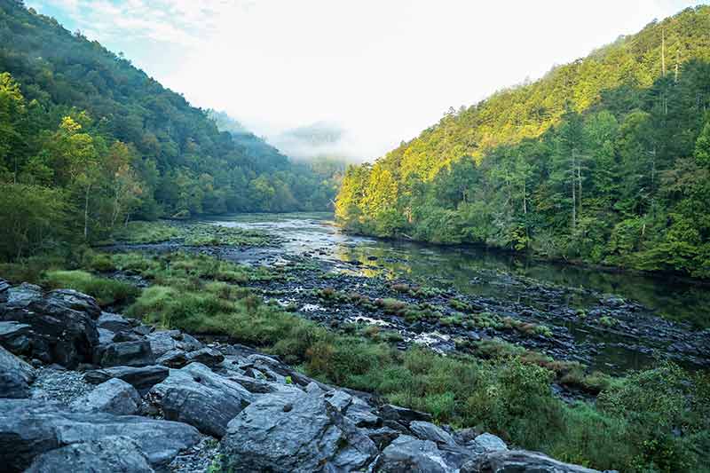
The endangered Ruth's golden aster flower grows in only a few places in the world, including along remote reaches of the Hiwassee River.
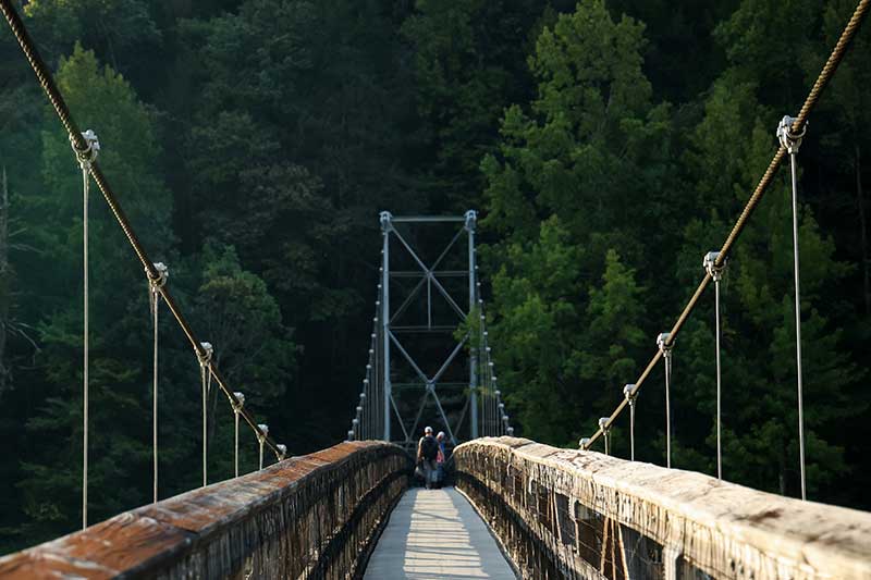
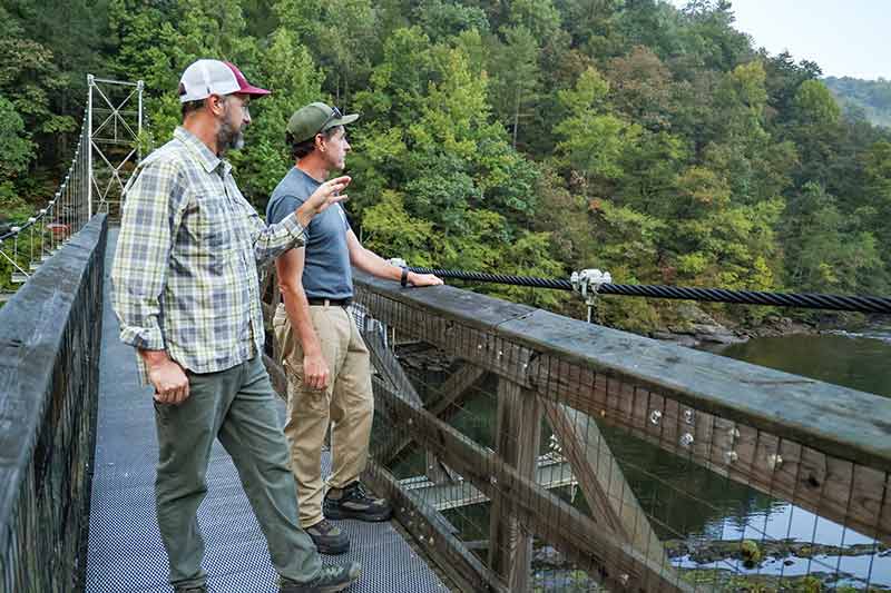
Scientists, aviators and river managers cross a long bridge spanning the Hiwassee River.
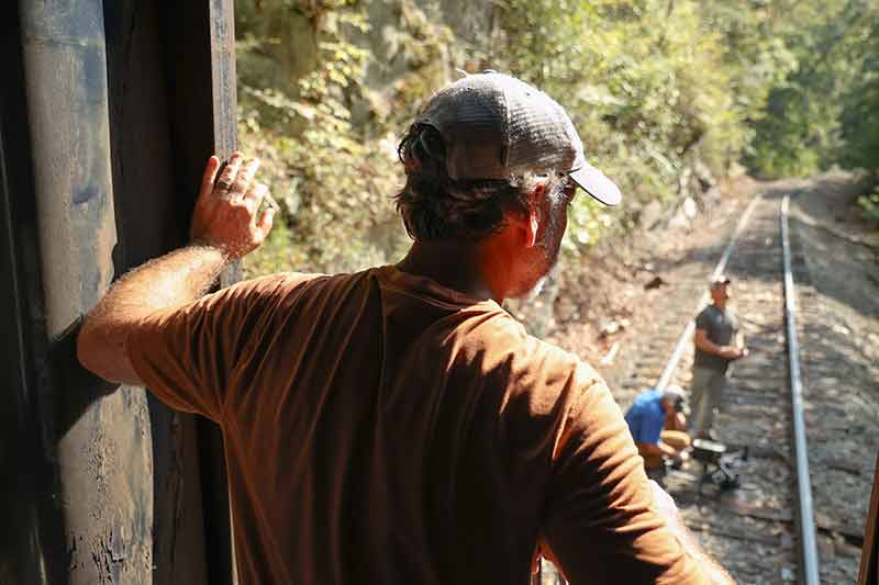
Geoff Call, U.S. Fish and Wildlife Service, watches drone launches from the train.
TVA botanist David Mitchell and Tennessee Department of Environment and Conservation vegetation ecologist Adam Dattilo ride the train to map Ruth's golden aster habitat.
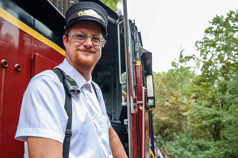
Monroe, conductor for the Tennessee Valley Railroad.
Land and Moyers prepare the drone for another launch.
Land, Moyers and Mitchell track a drone as the train rolls beside the Hiwassee River.
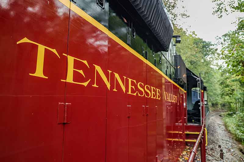
The Tennessee Valley Railroad offered train service for the team of scientists and aviators mapping the endangered Ruth's golden aster.
Mitchell rides the Tennessee Valley Railroad as part of the mapping mission.
Monroe communicates with train engineer Jodie Brantley.
Moyers, Land and Mitchell cross-reference habitat and river maps with GPS as they plan drone-launching sites.
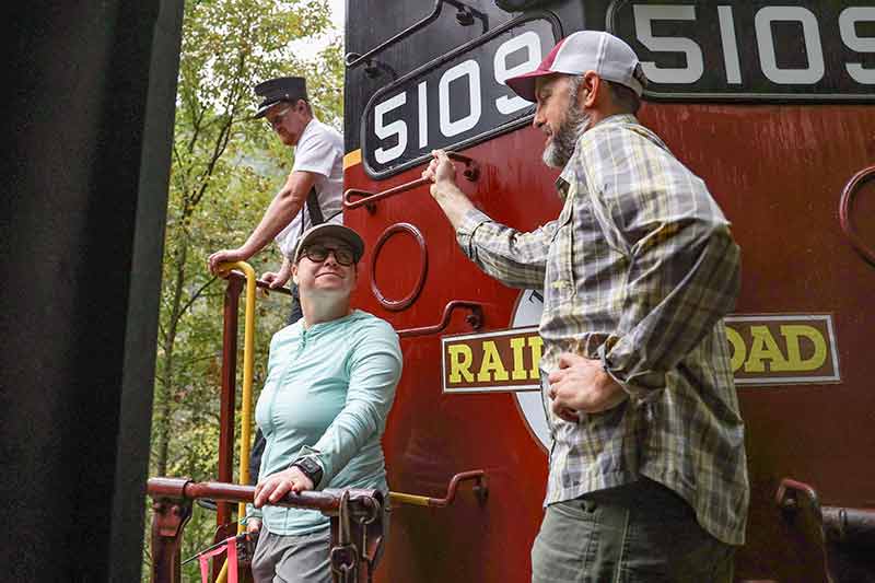
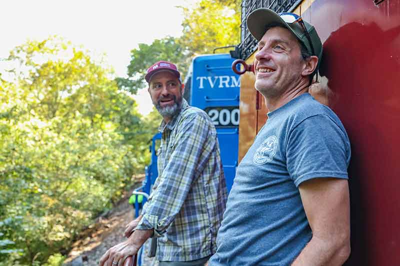
Moyers, Land, Call and Monroe gather on the train's observation deck.
Moyers and Land point out populations of yellow Ruth's golden aster growing on rock slabs.
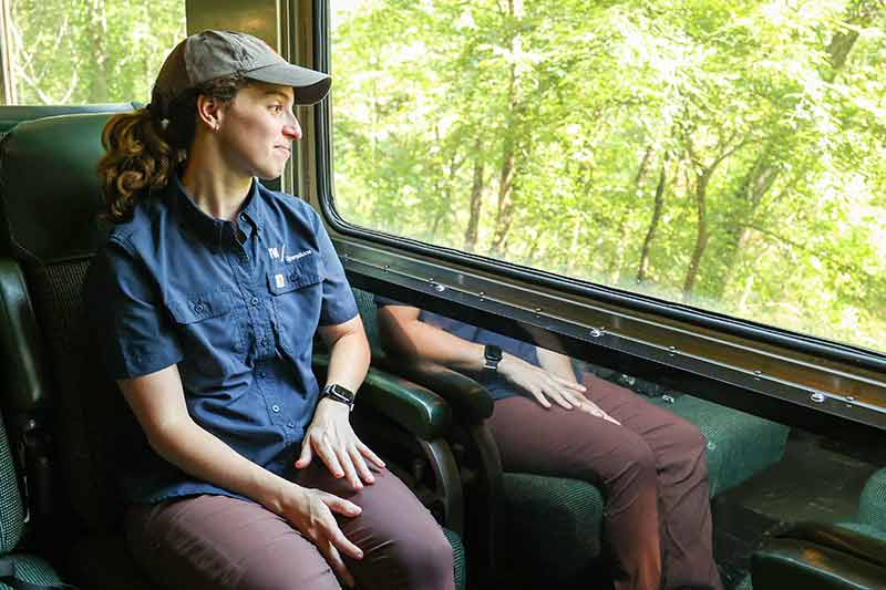
TVA's River Forecast Center engineer Salley Reamer, who works to coordinate river flows, watches the Hiwassee River from a vintage Tennessee Valley Railroad car.
Monroe watches Land and Moyers launch a drone.
The Hiwassee River Scenic Railroad, part of the Tennessee Valley Railroad, offers unparalleled access to remote Ruth's golden aster habitat.
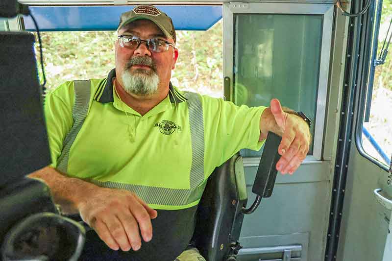
Tennessee Valley Railroad engineer Jodie Brantley chats during a stop along the route.
TVA and partners collaborated with the Tennessee Valley Railroad to access remote reaches of the Hiwassee River.
Mitchell and Dattilo discuss Ruth's golden aster mapping on a bridge near the Apalachia powerhouse.
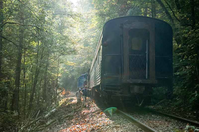
The team travels alongside the Hiwassee River by train to map Ruth's golden aster habitat.
The Tennessee Valley Railroad follows the steep banks of the Hiwassee River, where the endangered Ruth's golden aster grows on sun-washed rock slabs.
Moyers launches the drone from train tracks.
TVA's drone sets off on another photography flight over the river.
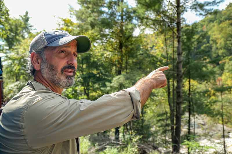
Call points at Ruth's golden aster habitat.
PHOTO AT TOP OF PAGE: Moyers and Land launch a drone to map Ruth's golden aster habitat.
Susan Ehrenclou
Staff Writer
Share this story: ' fill='%23414141'%3E%3Cpath d='M0 0h314v314H0z'/%3E%3C/g%3E%3Cg transform='translate(6 4)'%3E%3Cmask id='d' fill='%23fff'%3E%3Cuse xlink:href='%23c'/%3E%3C/mask%3E%3Cuse fill='%23FFF' xlink:href='%23c'/%3E%3Cg mask='url(%23d)' fill='%23FFF'%3E%3Cpath d='M-149-165h300v318h-300z'/%3E%3C/g%3E%3C/g%3E%3C/g%3E%3C/svg%3E%0A)
' fill='%23414141'%3E%3Cpath d='M0 0h314v314H0z'/%3E%3C/g%3E%3Cg transform='translate(4 5)'%3E%3Cmask id='d' fill='%23fff'%3E%3Cuse xlink:href='%23c'/%3E%3C/mask%3E%3Cuse fill='%23FFF' xlink:href='%23c'/%3E%3Cg mask='url(%23d)' fill='%23FFF'%3E%3Cpath d='M-167-171h323v327h-323z'/%3E%3C/g%3E%3C/g%3E%3C/g%3E%3C/svg%3E%0A)
' fill='%23414141'%3E%3Cpath d='M0 0h314v314H0z'/%3E%3C/g%3E%3Cg transform='translate(4.26 4)'%3E%3Cmask id='d' fill='%23fff'%3E%3Cuse xlink:href='%23c'/%3E%3C/mask%3E%3Cuse fill='%23FFF' xlink:href='%23c'/%3E%3Cg mask='url(%23d)' fill='%23FFF'%3E%3Cpath d='M-150-157h300v300h-300z'/%3E%3C/g%3E%3C/g%3E%3C/g%3E%3C/svg%3E)
Want more stories from The Powerhouse? Sign up to receive a monthly digest in your email.
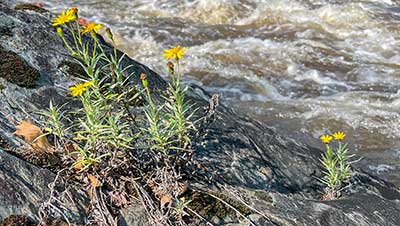
Ruth’s golden aster
Ruth’s golden aster drives its roots into rocky crevices of sun-baked riverside slabs, eking out an existence in harsh conditions. It depends on soil deposited over time as water levels rise and fall.