'%3E%3Cmask id='b' fill='%23fff'%3E%3Cuse xlink:href='%23a'/%3E%3C/mask%3E%3Cuse fill='%23414141' xlink:href='%23a'/%3E%3Cg mask='url(%23b)' fill='%23414141'%3E%3Cpath d='M-160-170h300v300h-300z'/%3E%3C/g%3E%3C/g%3E%3C/g%3E%3C/svg%3E)
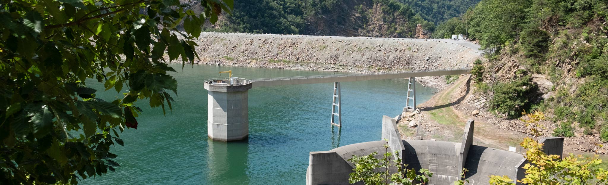
Watauga
At more than 1,900 feet above sea level, Watauga holds the distinction of being the highest reservoir in the Tennessee River system. The reservoir is managed for many uses, including flood damage reduction, power generation, water quality, and aquatic ecology.
Surrounded by the Cherokee National Forest and flanked by the Appalachian Mountains, Watauga Reservoir is one of the most scenic in the Tennessee River watershed. It offers access to the Appalachian Trail.
Below Watauga Dam is a wildlife observation area where visitors have a chance to view unique species of wintering waterfowl, including buffleheads, mallards, American black ducks, gadwalls, ring-necked ducks, lesser scaups and other ducks, including canvasbacks, redheads and scoters.
Watauga: Facts & Figures
- Construction of Watauga Dam began in early 1942 but was curtailed later that year in favor of other wartime building efforts. Work resumed in 1946, and the dam was completed in 1948.
- Watauga Dam is 318 feet high and extends 900 feet across the Watauga River.
- Watauga Dam is a hydroelectric facility. It has two generating units with a summer net dependable capacity of 63 megawatts. Net dependable capacity is the amount of power a dam can produce on an average day minus the electricity used by the dam itself.
- In a year with normal rainfall, the water level in the reservoir varies about 11 feet from summer to winter to provide for seasonal flood storage.
- Watauga has a flood-storage capacity of 152,800 acre-feet.
More Information on Watauga Reservoir
Celebrate TVA Dams

The Unified Development of the Tennessee River plan stressed TVA was to provide flood control, navigation and electricity for the region. TVA’s dams are tangible evidence of its primary mission: improving life in the Tennessee Valley. We’re celebrating the plan with an in-depth look at 32 of the dams it comprises.
The Town that Wouldn’t Drown
From the time of its founding in the 1760s, Butler, Tenn., was constantly inundated with floodwaters from the Watauga River—so much that flooding was considered a way of life. TVA was eventually convinced to correct conditions in the region by building Watauga Dam, and Butler became the largest and only incorporated town ever to be deluged in the building of a reservoir. But rather than let it be dissolved, TVA helped move the whole town to higher ground. Read the amazing story of Butler, Tenn.
Tailwater Pursuits
Kayaking, rafting and trout fishing—all activities that you can do in the tailwaters below TVA dams—are growing in popularity. Find out more about how you can “go with the flow” and get involved with these fun sports.